Skip to content
Public transport dispatching (24/7):
495 546 095
Customer Centres
EN
EN
CZ
Timetables
Search timetables
Maps and diagrams of public transport
Timetables for download
Changes in public transport
Tickets
Quick ticket selection
Total ticket overview
Method of ticket purchase
Ticket holders
Contractual Conditions of Carriage
News
Careers
Other services
About us
About the company
Public transport customer centres
Public transport terminal
For the media
Events for the public
Dopravák magazine
Documents and forms
Contact
Timetables
Search
Maps and diagrams of public transport
Timetables for download
Changes in public transport
Tickets
Quick ticket selection
Total ticket overview
Method of ticket purchase
Ticket holders
Contractual Conditions of Carriage
News
Careers
Other services
About us
About the company
Public transport customer centres
Public transport terminal
For the media
Events for the public
Dopravák magazine
Documents and forms
Contact
Client zone
Instructions and information
Access to the client area
Client zone
Instructions and information
Access to the client area
Instructions and information
Access to the client area
Instructions and information
Access to the client area
Home
»
Timetables
»
Maps and diagrams of public transport
Maps and diagrams
Public transport stops on the map
Download
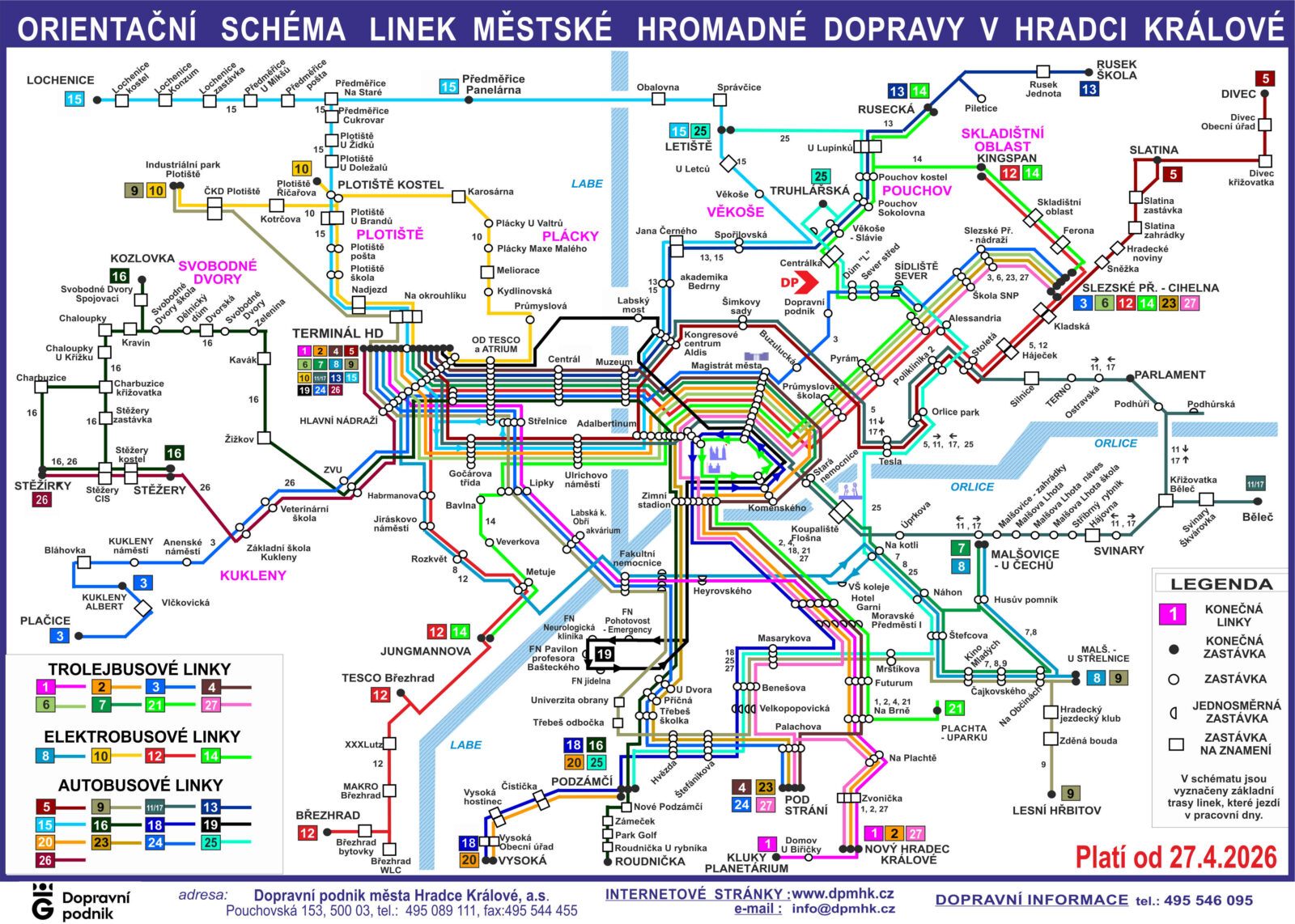
Diagram of public transport lines
download PDF
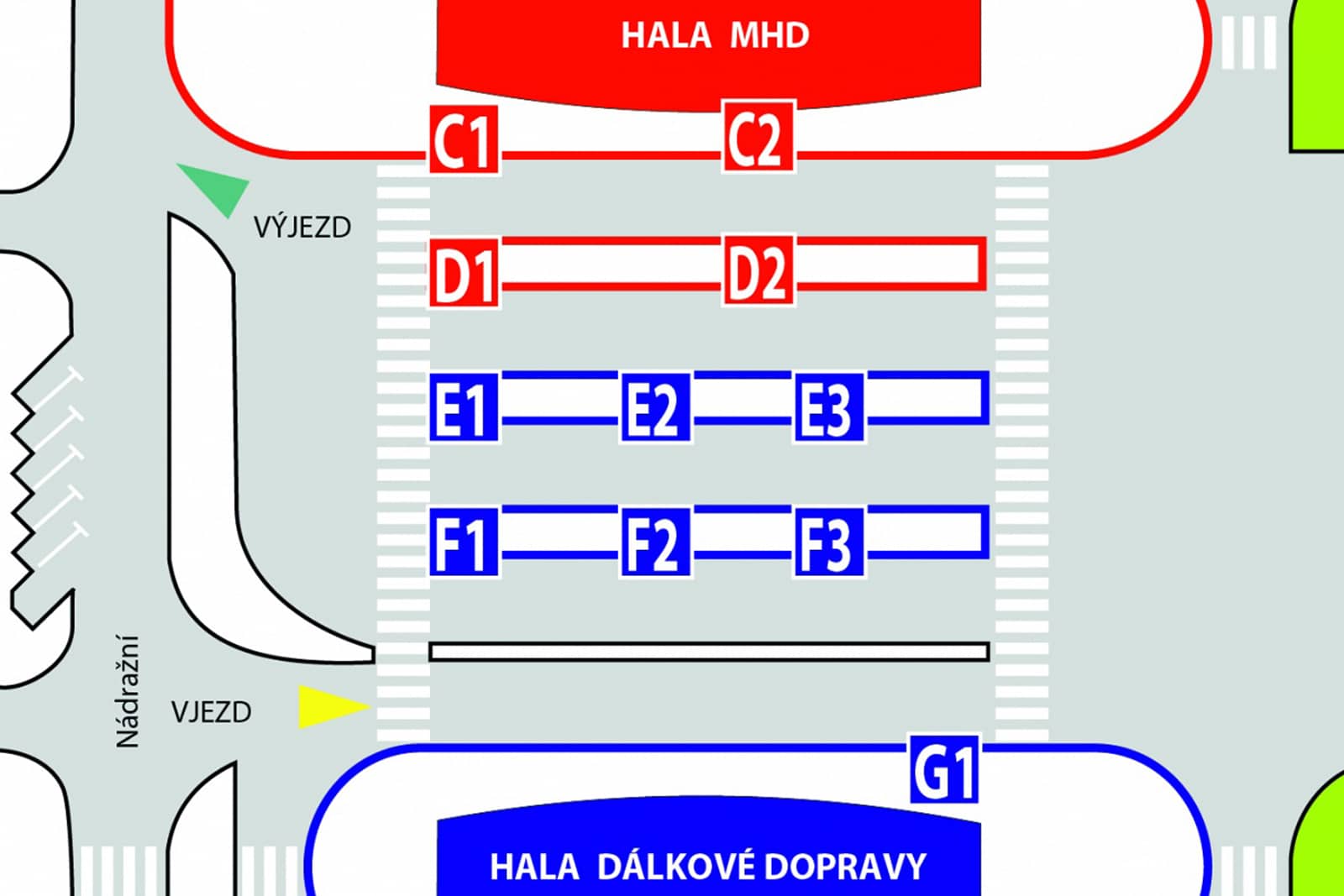
Schematic of the Public Transport Terminal
Download JPG
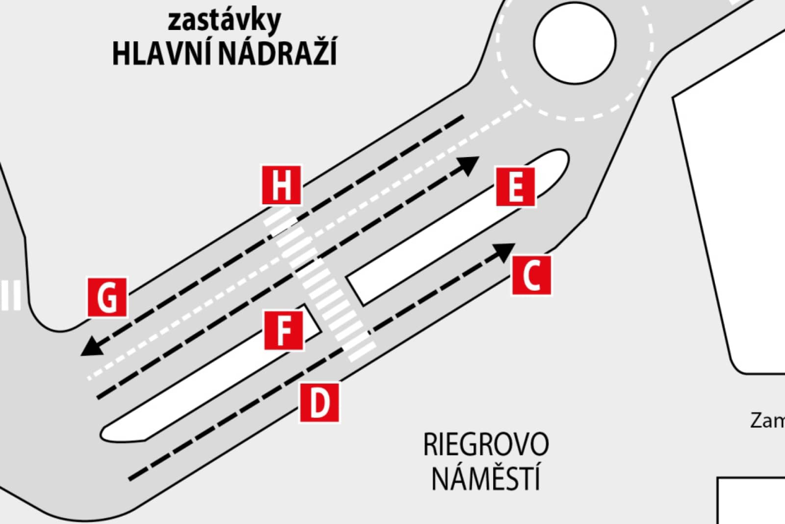
Diagram of the stops at the main station (Rieger Square)
download PDF
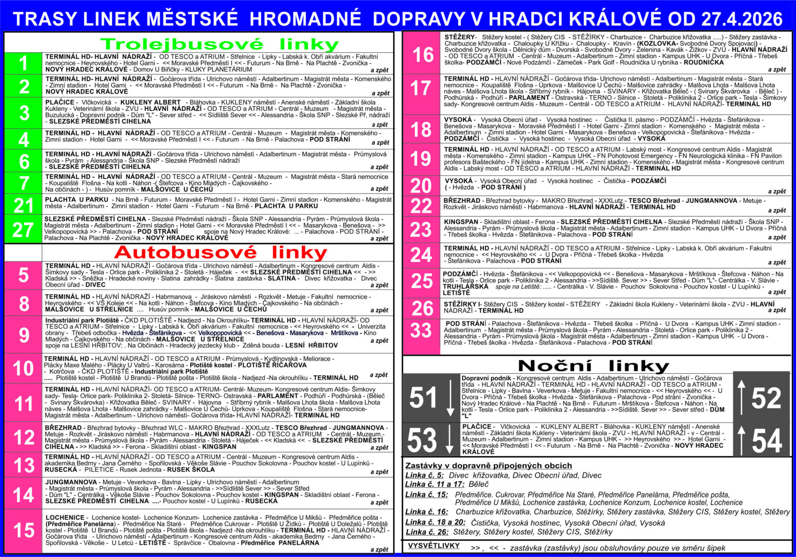
Link routes
download PDF

 EN
EN